Hectometric Borna
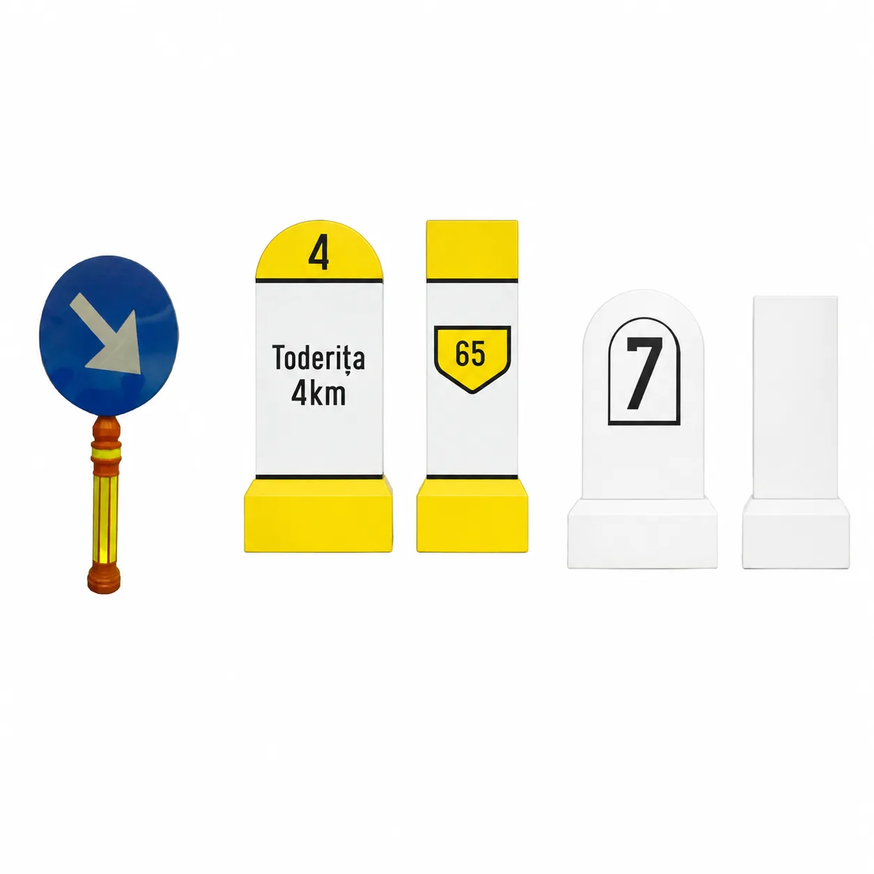
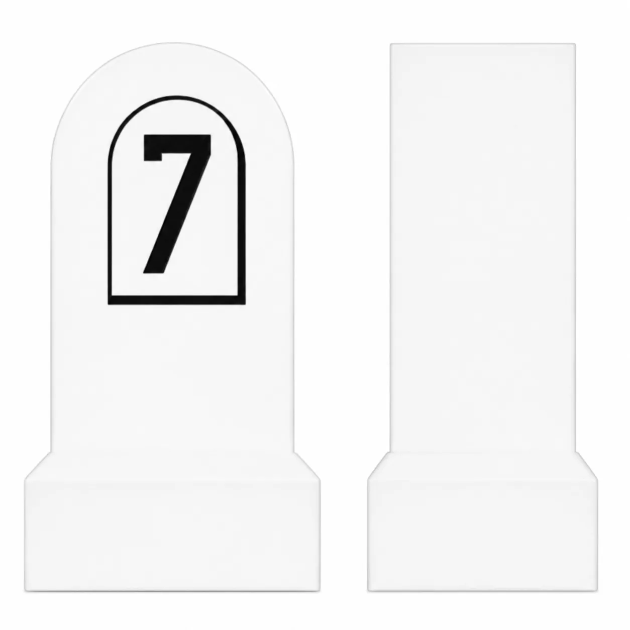
The hectometric Borna is a 100-metre road sign used for the exact identification of the position on a road in relation to the reference kilometer. It helps to guide, maintain infrastructure and quickly locate in emergency situations, even if many drivers observe it without paying attention.
In short: the kilometre range shows the kilometre, and the hectometric range marks every 100 meters between two consecutive kilometers.
Do you need help choosing?
Tell us what you need and we'll send you the offer on the same working day.
Hectometric terminals are used by road managers, maintenance teams and emergency services. In the event of a road accident, they shall allow for the transmission of an exact location and shall reduce the time necessary for the intervention of ISU crews. In maintenance work, they help to delineate the slats accurately, and together with the mileage, delineation and infrastructure terminals form a coherent system of landmarks across the road network.
O hectometric is a 100-metre road sign used for the exact identification of the position on a road. This helps to orient, maintain infrastructure and quickly locate in emergency situations.
Hectometric pillar – find out what it represents, how it is read and why it is essential for guidance, road management and rapid interventions.
Hectometric Borna – what it is, how it is read and why it is important
O hectometric is one of those road elements that most drivers observe without paying too much attention. However, its role is essential both for road management and for the guidance of traffic participants and emergency interventions.
Whether you're travelling on a national road, county or highway, these terminals provide accurate information about your position on the route. In this article you will find out what a hectometric boundary represents, how the information entered is interpreted and where it becomes indispensable.
What's a hectometric terminal?
O hectometric is a roadmark located at each 100 meters along a road. It shall complete the road mileage system and indicate the exact position reported at the reference km of the track.
These terminals are used by:
- Road managers;
- Road Police;
- The Emergency Inspectorate;
- ambulance services;
- maintenance teams;
- construction and infrastructure firms.
Usually, they're made from concrete, metal or weather resistant composite materials, being provided with reflective elements for high visibility during the night.
How does a hectometric terminal work?
Each road has one km zero or a starting point established by the infrastructure manager.
Starting from this, they are located:
- kilometre markers (each 1 km);
- Hectometric terminals (each 100 m).
The inscriptions generally contain:
- the number of the road (DN, DJ, DE, A etc.);
- km;
- the hectometre;
- Sometimes administrative or inventory codes.
Example
Inscription:
DN1 – KM 125 + 700
means that that position is at:
- km 125;
- Another 700 meters.
The location can thus be identified very precisely.
Why is a hectometric boundary important?
Importance of a Hectometer exceeds the mere traffic orientation.
It contributes to:
- rapid location of accidents;
- identification of problem areas;
- planning maintenance work;
- infrastructure inventory;
- monitoring of roads;
- management of emergency response.
In the absence of an accurate record, the location of an incident may significantly delay the arrival of the crews.
Advantages of using hectometric terminals
Key benefits include:
- the exact identification of the position on the road;
- reducing the time taken to intervene in the event of an accident;
- efficient management of road infrastructure;
- planning maintenance work;
- easier guidance for traffic participants;
- support for modern GIS and mapping systems.
These milestones are also used in professional applications dedicated to road infrastructure management.
Types of road terminals
Depending on their role, there are several categories.
Kilometre marker
Indicates every mile along the route.
Hectometric Borna
Indicates each 100-metre segment of two km markers.
Delimitation terminal
Mark administrative or territorial boundaries.
Infrastructure terminal
Used in technical work to identify the objectives of the route.
Difference between hectometric and marker kilometres
Although they are similar, the two have different purposes.
| Hectometric Borna | Kilometre marker |
|---|---|
| located at 100 m | located at 1 km |
| indicates the very precise position | indicate main kilometer |
| used for exact location | used for general guidance |
| provides additional details | provides the main benchmark |
In practice, the two complement each other.
Frequent errors in interpretation of hectometric terminals
Many traffic participants confuse the displayed information.
The most common mistakes are:
- the interpretation of the hectometer as a mileage;
- ignoring the sense of increase in mileage;
- incomplete transmission of the position to emergency services;
- confusion between different roads with similar numbers.
The correct transmission of information may make a difference in the case of rapid intervention.
How do the administrators choose the location of the terminals?
Positioning of a Hectometer comply with the rules laid down by the technical rules on road administration.
They're following:
- high visibility;
- standardised distances;
- traffic resistance and weather;
- easy to identify;
- compatibility with inventory systems.
In many cases, the terminals are regularly replaced to maintain readability.
Practical example of use
Road accident
A driver may announce:
"Accident on DN7, at km 254 + 300."
Dispatch immediately locates the area.
Maintenance work
The administrator shall plan:
"Repairs between km 58 + 200 and km 59 + 600."
There is no further ambiguity about the sector concerned.
ISU interventions
Equipment quickly identifies the exact position without further explanation.
Recommendations for drivers
When travelling on national roads or motorways:
- observe the mileage and hectometric terminals;
- retain the kilometer if a problem arises;
- communicate the full position when calling emergency services;
- do not damage or change the terminals;
- use these markers together with GPS applications for the most accurate location.
Conclusion
Although it seems like a simple element, Hectometric bollard has an essential role in road infrastructure. It allows for accurate identification of the road position, facilitates emergency response, supports maintenance work and contributes to efficient road network management.
For drivers, knowing how to interpret these milestones can be extremely useful in unforeseen situations, and for road managers it is an indispensable tool in infrastructure management.
BENEFICII COMERCIALE
- Precise location on any road sector.
- Rapid identification in case of accident or damage.
- Support for intervention and maintenance teams.
- Effective management of road infrastructure.
- Compliance with the standards of signalling and inventory.
- High visibility due to reflector elements.
- Durability under traffic conditions and weather conditions.
- Reduction of intervention times and operational costs.
FAQ
What's a hectometric terminal?
It is a roadmark located every 100 meters for the exact identification of the position on a road.
What information contains a hectometric boundary?
The number of the road, the km and the hectometre of that position shall normally be indicated.
Where are the hectometre terminals located?
On national, European, county, motorway and other roads officially managed.
How do you read a hectometric terminal?
It is interpreted as the number of the kilometer plus the additional distance expressed in hundreds of metres.
Who uses hectometric terminals?
Road managers, police, emergency services, builders and traffic participants.
What is the difference between marker kilometers and hectometric boundary?
The kilometre line marks every kilometre, and the hectometre line every 100 meters.
Are hectometric terminals mandatory?
Yes, they are part of the road infrastructure identification and management system, in accordance with the applicable rules.
Why are they important in the event of an accident?
I allow the transmission of an exact location, reducing the time required for emergency crew intervention.
O hectometric Mark every 100 metres of a road and indicate the exact position relative to the reference km. This is essential for guidance, infrastructure maintenance and rapid location in emergency situations, contributing to increased road safety.